
The world’s leading App for monitoring river conditions at over 40,000 sites across Europe, North America, Australia and New Zealand.

Features
RiverApp makes checking river levels, flows and temperatures quick and intuitive. We aggregate data from more than 80 sources in over 20 countries in real-time so you can spend more time by the water.
Seamless and lightning-fast
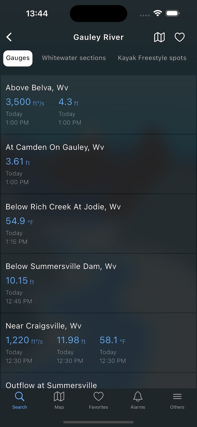
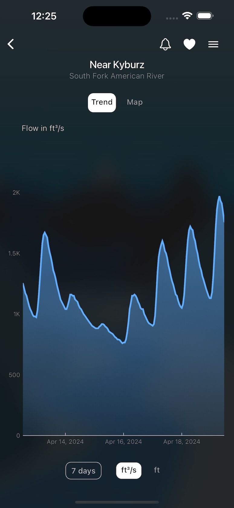
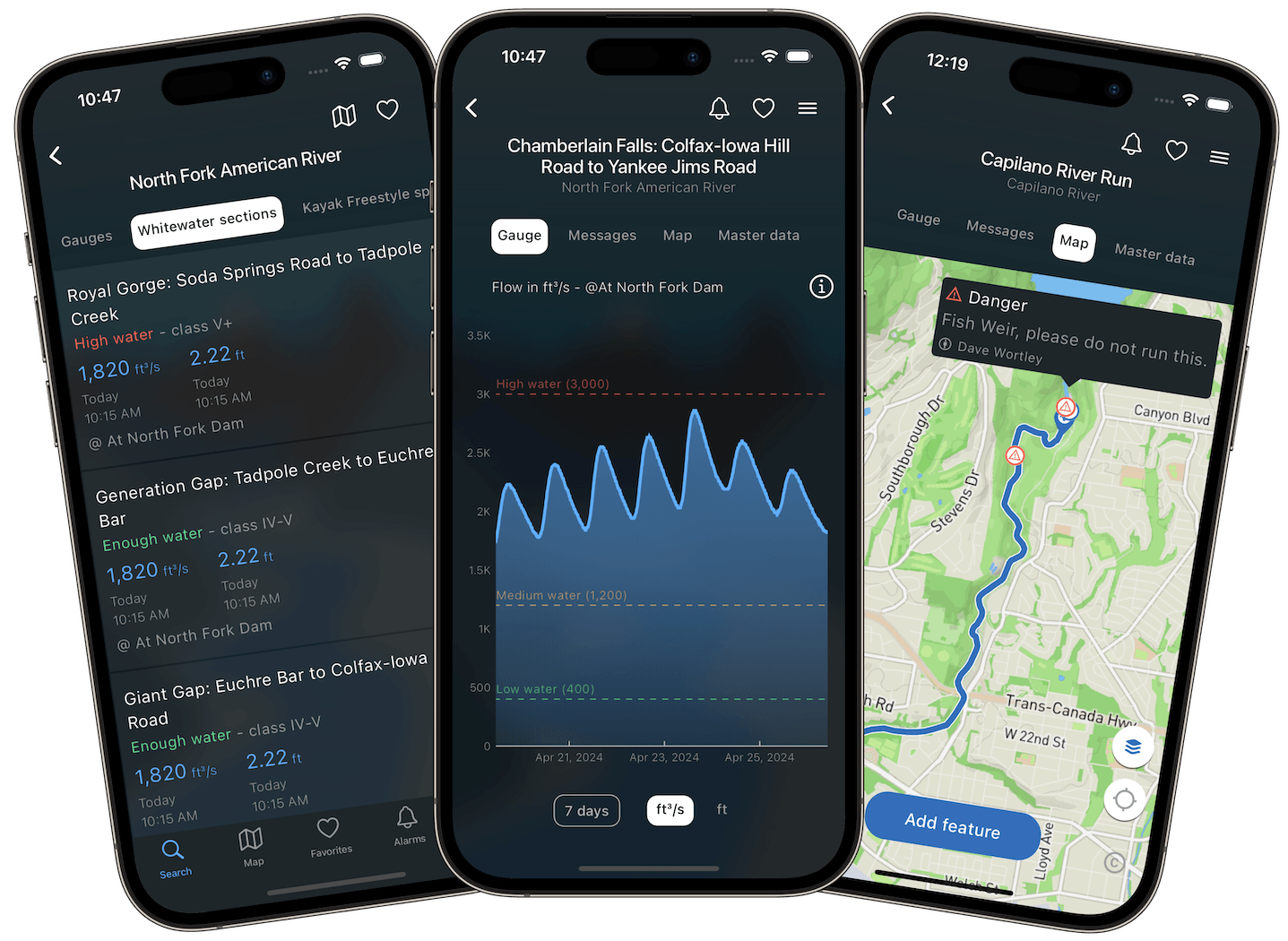
Instant access to current flows, levels, and water temperatures, as well as historical data for over 20,000 rivers.
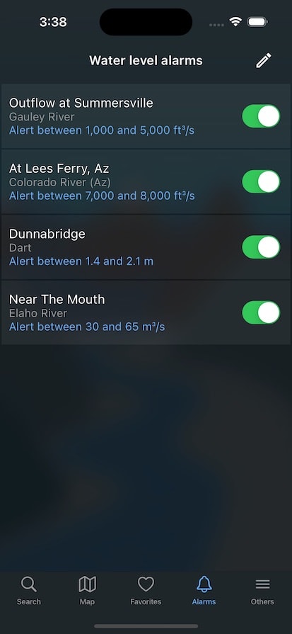
Water level alert
Receive personalized alerts by push notification when the river reaches a predefined level or flow
Favorites
Instantly see the latest readings from your favorite rivers and gauges
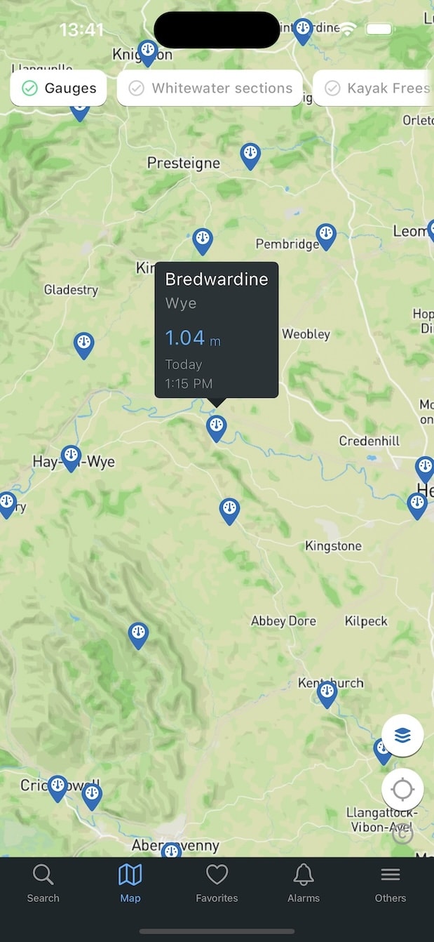
River Map
Mapping of gauging stations and whitewater runs
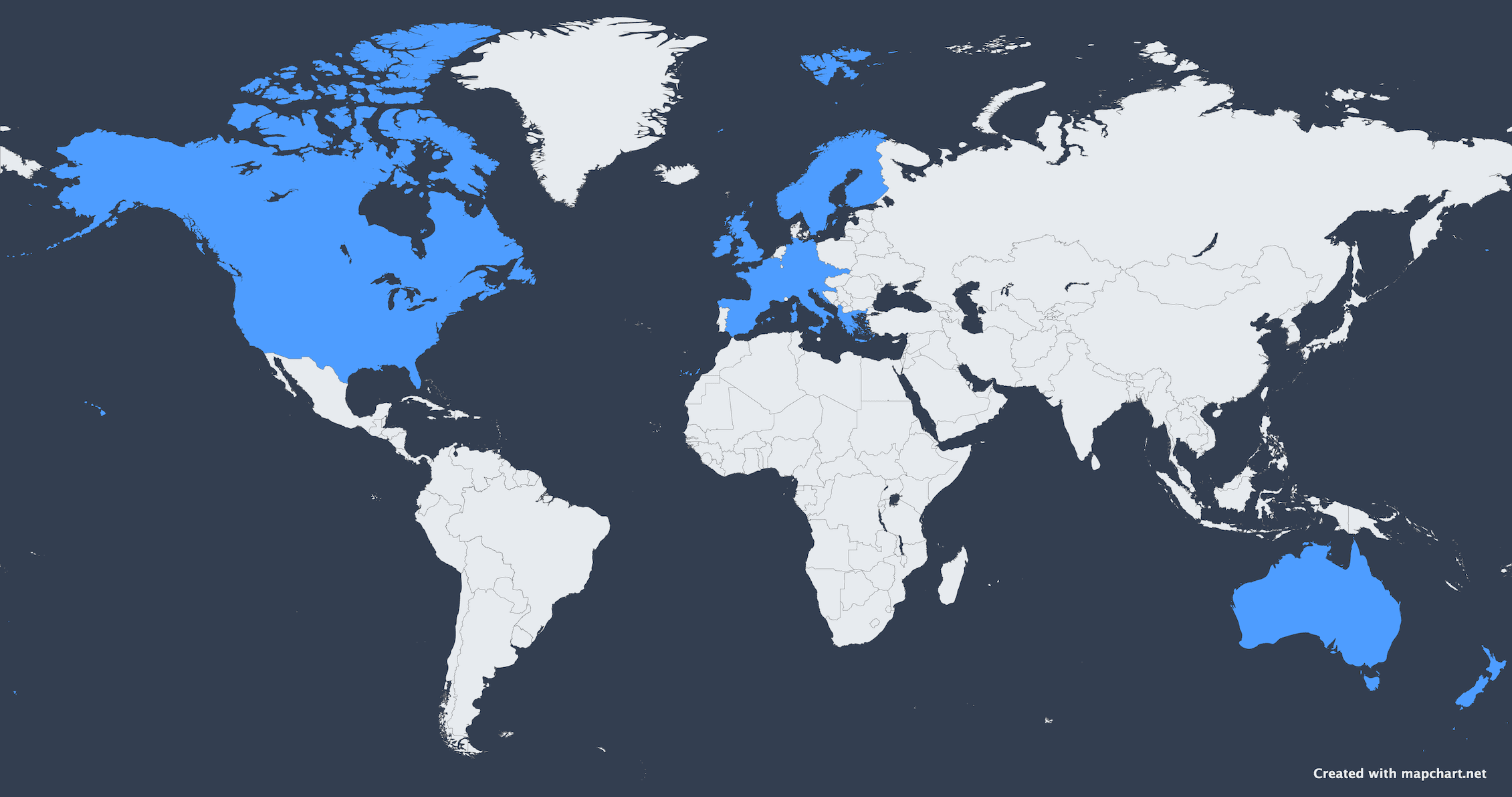
Coverage
RiverApp provides data for rivers in over 20 countries across Europe, North America, Australia and New Zealand aggregating information from more than 80 hydrological institutes. With over 800,000 users worldwide, RiverApp is the leading App for river enthusiasts
The ultimate whitewater App
RiverApp gives you peace of mind to tackle your next whitewater adventure, whether kayaking, stand-up paddling, rafting, pack-rafting or canyoning.
Stay up-to-date with current conditions for more than 4,000 whitewater sections and freestyle kayak spots.
Get the whole picture with maps including including kayak & rafting put-in and take-out points, plus dams, impassable rapids and car park locations. Eight map types available, including several satellite maps.
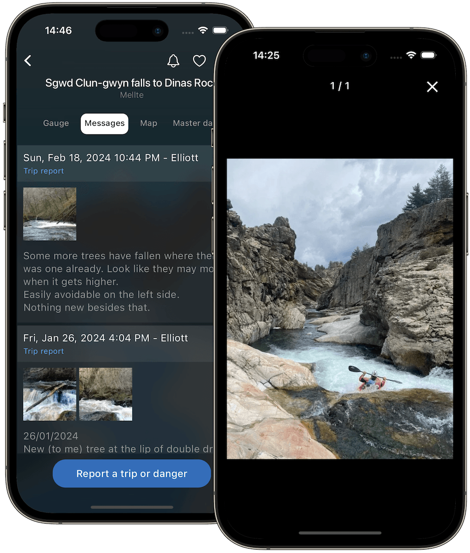
Access the latest information posted by the RiverApp community like hazards, legal issues and trip reports.
Better plan your route down the River with river sections data including difficulty levels, whitewater length and average gradients.